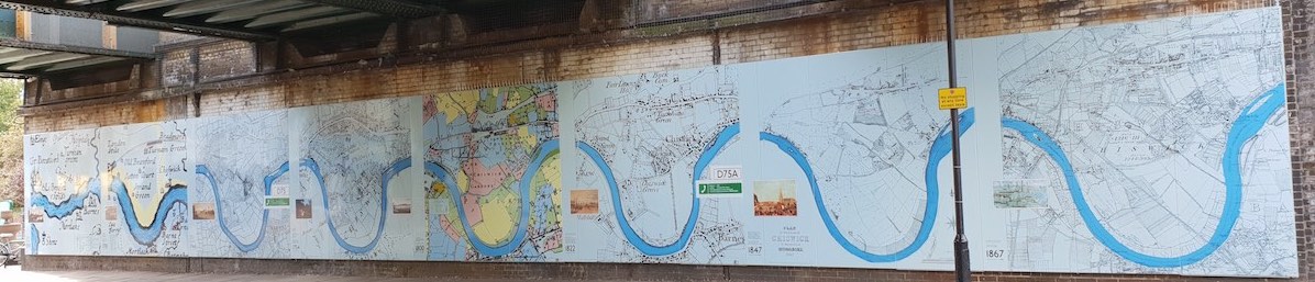
See all the maps on the Chiswick Timeline mural at Turnham Green tube station (above). See them below with historical information, images and explanatory videos with Karen Liebreich and Sarah Cruz on Chiswickbuzz.
 1593 by John Norden. See online.
1700 by William Knight. See online.
1746: John Roque’s Exact Survey. See online.
1754: John Roque’s County of Middlesex. See online.
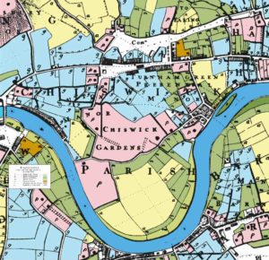
1800: Thomas Milne’s Land Plan (right) . See online.
1822: The first Ordnance Survey map. See online.
1847: The Tithe map of Chiswick. See online.
1867: Ordnance Survey map, 6 ins to a mile. See online.
1893: Ordnance Survey map, with more housing. See online.
1914: Ordnance Survey map, 25 ins to a mile. See online.
1938: The first Geographers’ A-Z map. See online.
1939-45: Bomb Damage map. See online.
1949: Ordnance Survey, with lots more housing. See online.
1962: Geographers’ A-Z, with Chiswick Flyover. See online.
1994: Geographers’ A-Z, with lots more details. See online.
2018: Legible London, as used for our Art Trail and Writers Trail. See online.
.
Back to Exploring Chiswick